Taiwan's Wetlands of Importance
Map of Taiwan's Wetlands

-
Number
TW069
-
Area
171 ha
-
Chinese Name
茄萣濕地
-
Category
Artificial wetland and small portions of coastal natural wetland
-
Name
Jiading Wetland
-
Administrative area
Jiading District, Kaohsiung City 120o11'44
-
Related plans
N/A
-
Related authorities or units
Kaohsiung City Government
-
Boundaries
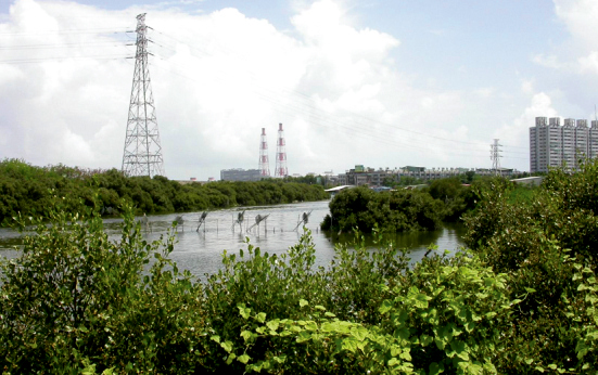
The wetland, a defunct salt pan, is situated in the Jiading District of Kaohsiung City. It extends east and north to fish pond ditches, and west to Kao-1 Road (Chilou Road), and south to a mangrove ditch at Hsinda Harbor.
-
Introduction
In 1991, Jhuhu Salt Pan ceased salt production due to the establishment of Hsinda High Sea Fishery Harbor. In Sep. 2011, Ministry of the Interior approved the establishment of Jiading Wetland Nature Park.
-
Ecological resources of importance
Mangrove trees in the wetland are predominantly Black Mangrove, with smaller populations of Lumnitzera racemosa and Red Mangrove. Some mangroves' diameter at breast height (DBH) can reach 30 cm, indicating that the trees are over 100 years old. About 140 species of birds have been observed in the wetland, including Chinese Egret, Black-faced Spoonbill, Oriental White Stork, Grey Frog Hawk. Three thousand Kentish Plovers have been recorded in the wetland.
-
Endangered species
Black-faced Spoonbill, Oriental White Stork, Peregrine Falcon.
-
Rare and valuable species
Little Tern, Chinese Egret, Grey Frog Hawk, Grey-faced Buzzard-Eagle, Osprey, Besra Sparrow Hawk, Crested Serpent Eagle.
-
Types to be conserved
Brown Shrike, Eastern Collared Pratincole.
-
The current situation and potential threats of wetlands
The ditches of the old salt pan have been clogged in recent years. The expansion of Hsinda Harbor and the opening of Provincial Highway 17 have increased waste pollution, which adversely affects the wetland's ecosystem.
-
Participating in recommended units
Wetlands Taiwan
